


Video: Guide to California State Parks
California is filled with adventure and amazing landscapes to explore. From mountain ranges to sa...
Read Article
GPS: 41.2375, -105.9014
Accessibility is not guaranteed, always scout ahead before driving down dirt roads.
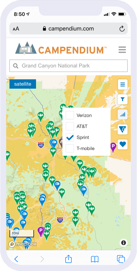
Learn more: Boondocking 101
Reported by camper-877031 on 10/6/2023
Reported by JuJu on 8/25/2021
Elevation 7,283 ft / 2,219 m
Max Stay 5
Tent Camping Yes


Reviewed 10/6/2023
| Nightly rate: | FREE! |
|---|---|
| Days stayed: | 2 |
I stayed 2 nights, tent camping with my dog. The first night, we were awakened by the sounds of animals outside. Upon opening the flap, I observed 3 horses in the campsite. Since I had determined that it wasn't a bear, I came on out and found myself in the middle of a large herd of horses. The 2nd night was not nearly so eventful. Th... more
I stayed 2 nights, tent camping with my dog. The first night, we were awakened by the sounds of animals outside. Upon opening the flap, I observed 3 horses in the campsite. Since I had determined that it wasn't a bear, I came on out and found myself in the middle of a large herd of horses. The 2nd night was not nearly so eventful.
There are basically no trees around the campsites, and it's essentially camping in a pasture. Cell service on Verizon was 1 bar at best, calls and texts, but no data service.
| Access | |
| Location | |
| Cleanliness | |
| Site Quality | |
| Noise |
camper-877031 would stay here again
This review is the opinion of a Campendium member and not of Campendium.com
Reviewed 8/20/2023
| Nightly rate: | FREE! |
|---|---|
| Days stayed: | 2 |
We tow a 46’ toy hauler so we dropped the trailer at the entrance to find a spot. Some of the sections of “road” inside the area are a little washed out so we were glad we did this. Also google maps took us to the wrong place, we drove towards two buttes and then followed road signs to get here. There were a few weekenders running gen... more
We tow a 46’ toy hauler so we dropped the trailer at the entrance to find a spot. Some of the sections of “road” inside the area are a little washed out so we were glad we did this. Also google maps took us to the wrong place, we drove towards two buttes and then followed road signs to get here.
There were a few weekenders running generators and music into the evening but everyone was so far apart we didn’t hear them at all when we went to sleep.
The wind was mostly not anything to write home about until it was - then it almost blew all of our chairs into the lake. Same for the bugs. The little flies were bad during the day time but we didn’t have trouble keeping them out of the camper.
All in all a gorgeous spot for a boondocking stint over the weekend with enough spots that we could pull our toy hauler and set up. Would definitely come back!
| Access | |
| Location | |
| Cleanliness | |
| Site Quality | |
| Noise |
Hbrand1 would stay here again
This review is the opinion of a Campendium member and not of Campendium.com
Reviewed 7/26/2023
| Nightly rate: | FREE! |
|---|---|
| Days stayed: | 5 |
We woke to a herd of horses on the beach one morning. The day before we were entertained by a group of kite surfers. We’ve seen comical prairie dogs, serene pronghorn, and scat from something much, much larger. Decent cell signal on AT&T. Majestic views, clean sites, and a near constant breeze that changes to a gale at times. All th... more
We woke to a herd of horses on the beach one morning. The day before we were entertained by a group of kite surfers. We’ve seen comical prairie dogs, serene pronghorn, and scat from something much, much larger. Decent cell signal on AT&T. Majestic views, clean sites, and a near constant breeze that changes to a gale at times. All this for free. Thank you Wyoming!
| Access | |
| Location | |
| Cleanliness | |
| Site Quality | |
| Noise |
camper-816657 would stay here again
This review is the opinion of a Campendium member and not of Campendium.com
Reviewed 8/14/2022
| Nightly rate: | FREE! |
|---|---|
| Days stayed: | 1 |
Five stars for a beautiful view, fire pits, picnic tables, vault toilets, and fantastic cell service! It was windy, but not so windy we were bothered in a tent. There were a ton of bugs, but not the biting kind. The vault toilets have unfortunately been abused, it looked like there was a deflated inner tube in one. Also a ton of ceilin... more
Five stars for a beautiful view, fire pits, picnic tables, vault toilets, and fantastic cell service! It was windy, but not so windy we were bothered in a tent. There were a ton of bugs, but not the biting kind. The vault toilets have unfortunately been abused, it looked like there was a deflated inner tube in one. Also a ton of ceiling spiders in the vault toilet house. Overall, still great for a free site, especially one with such easy access.
| Access | |
| Location | |
| Cleanliness | |
| Site Quality | |
| Noise |
camper-638229 would stay here again
This review is the opinion of a Campendium member and not of Campendium.com
Reviewed 8/8/2022
| Nightly rate: | FREE! |
|---|---|
| Days stayed: | 5 |
| Site Number: | N/A |
| RV Length: | 25' (Truck Camper) |
2nd year at Lake Hattie. The wind is still windy and the nights are still star filled. We enjoyed this site enough last year that we decided to come back after the tiny house festival in Loveland, Co. It is still a beautiful area with not too much traffic during the week. The weekends get a little busier but not obnoxiously so. The... more
2nd year at Lake Hattie. The wind is still windy and the nights are still star filled. We enjoyed this site enough last year that we decided to come back after the tiny house festival in Loveland, Co.
It is still a beautiful area with not too much traffic during the week. The weekends get a little busier but not obnoxiously so.
The lake is way down from our visit a year ago but still clean and good for early morning paddle boarding.
If you like peaceful lake kayaking or paddle boarding I recommend visiting this area.
Camping on the beach is allowed although we chose to stay up on the overlooks.
There are bugs! Not biting, just nuisance. Except the flys. But those are everywhere.
Right down the road is a prison museum and Laramie, Wyoming. So supplies are available.
There is no water, electric or trash at the lake. There is however a pit toilet! I DO NOT recommend using it! Not cleaned and appears to be the trash receptacle for some very disrespectful campers.
All in all not a bad location. Probably skip it next year however, mainly because of low water and poor maintenance.
| Access | |
| Location | |
| Cleanliness | |
| Site Quality | |
| Noise |
Calla’Venture would stay here again
This review is the opinion of a Campendium member and not of Campendium.com
Reviewed 8/25/2021
| Nightly rate: | FREE! |
|---|---|
| Days stayed: | 4 |
| RV Length: | 35' (Fifth Wheel) |
Great place to stay. If you have a street legal OHV it’s only 30 minutes to the trails on Medicine Bow Mtn. Stayed during the week and very quiet day and night. No shade, but okay for a free camping spot. Family of foxes nearby and fun to watch.
| Access | |
| Location | |
| Cleanliness | |
| Site Quality | |
| Noise |
JuJu would stay here again
This review is the opinion of a Campendium member and not of Campendium.com
Reviewed 7/22/2021
| Nightly rate: | FREE! |
|---|---|
| Days stayed: | 5 |
| Site Number: | N/A |
| RV Length: | 25' (Truck Camper) |
We stayed the 5 day limit above the beach with easy access to the lake. Kayaked and paddle boarded every day, early! Super clean/clear lake! Mornings were serene and mentally cleansing on the lake. Afternoons! Whew! The winds picked up and did they blow! Had one gust take our paddle board out into the lake! Had to swim for it! Tied it ... more
We stayed the 5 day limit above the beach with easy access to the lake. Kayaked and paddle boarded every day, early! Super clean/clear lake! Mornings were serene and mentally cleansing on the lake. Afternoons! Whew! The winds picked up and did they blow! Had one gust take our paddle board out into the lake! Had to swim for it! Tied it down afterwards. Easy access. Not too many people during the week. Weekends a little busy. Lots of power boats on weekends! Overall! An excellent camping location!
| Access | |
| Location | |
| Cleanliness | |
| Site Quality | |
| Noise |
Calla’Venture would stay here again
This review is the opinion of a Campendium member and not of Campendium.com
Reviewed 10/19/2020
| Nightly rate: | FREE! |
|---|---|
| Days stayed: | 1 |
| RV Length: | 34' (Toy Hauler Travel Trailer) |
Super great spot to park with great views, easy access, plenty of room for several rigs and only 30 minutes from Laramie. However, WY lived up to its unrelenting windy reputation with 25+ mph wind and gusts of 40+. Much to unsafe to put the slides out; which makes for a very cramped homestead and the rocking/swaying was enough to mak... more
Super great spot to park with great views, easy access, plenty of room for several rigs and only 30 minutes from Laramie. However, WY lived up to its unrelenting windy reputation with 25+ mph wind and gusts of 40+. Much to unsafe to put the slides out; which makes for a very cramped homestead and the rocking/swaying was enough to make me motion sick. These are the days I wish I had an travel trailer, so at least you could still have 100% of your living space available. Without the wind I would stay here for a while, but 1 night (with the forecast saying these winds will persist for days) was enough and I left the next day.
| Access | |
| Location | |
| Cleanliness | |
| Site Quality | |
| Noise |
walkerwalkabout would stay here again
This review is the opinion of a Campendium member and not of Campendium.com
Reviewed 7/15/2020
| Nightly rate: | FREE! |
|---|---|
| Days stayed: | 6 |
It actually it pretty nice there. Decent amount of spots. Clear water. Relatively quiet during weeknights. HOWEVER: the weekends attract the most inconsiderate campers you’ve ever come across. Loud generators, loud music late into the night, bright lights, and litter everywhere! Somebody next to us left their broken canopy behind! Just... more
It actually it pretty nice there. Decent amount of spots. Clear water. Relatively quiet during weeknights. HOWEVER: the weekends attract the most inconsiderate campers you’ve ever come across. Loud generators, loud music late into the night, bright lights, and litter everywhere! Somebody next to us left their broken canopy behind! Just left the heap of metal! And there was used toilet paper down by the water! We picked up as much trash as we could around our site, but it would’ve been a whole day’s endeavor to pick up everything we saw.
And then there’s the wind, which we knew about going in, but it truly is relentless. You might get a couple hours of calm in the morning, but the rest of the day can be nuts. One day we experienced 70mph winds out of nowhere and it trashed our trailer inside and out. At least the wind meant there weren’t any tiny green midge flies though. They’re harmless but small enough to fit through the screens.
It IS pretty though. And it’s free. However, I wouldn’t mind paying $10/night if it meant a camp host would be around to control generator use, noise into the late evening, and the litter issue.
| Access | |
| Location | |
| Cleanliness | |
| Site Quality | |
| Noise |
This review is the opinion of a Campendium member and not of Campendium.com
Reviewed 7/14/2020
| Nightly rate: | FREE! |
|---|---|
| Days stayed: | 1 |
| Site Number: | None |
Disbursed camping at its finest, found a nice spot at the end of the area Water was breathtaking as was the view and sunset We camped in a fully self contained truck camper so no restrooms needed and we didn’t have a boat which would’ve been fun!! Super windy when we got there and through the night but apparently that’s what Wyom... more
Disbursed camping at its finest, found a nice spot at the end of the area
Water was breathtaking as was the view and sunset
We camped in a fully self contained truck camper so no restrooms needed and we didn’t have a boat which would’ve been fun!!
Super windy when we got there and through the night but apparently that’s what Wyoming is known for
We used the restrooms on the way out but it wasn’t the cleanest due to free access to the public
| Access | |
| Location | |
| Cleanliness | |
| Site Quality | |
| Noise |
Smlkripp4 would stay here again
This review is the opinion of a Campendium member and not of Campendium.com
Be the first to add a note for Lake Hattie Public Access Area Dispersed Camping!
Be the first to add a video for Lake Hattie Public Access Area Dispersed Camping!
After spending a week at Government Gulley in Laramie, we were ready for a change of scenery…. but, we had to wait for a package to arrive at the Laramie Post Office. Fortunately, there are tons of...
Contact us to update this listing.

 3 Reviews
$100 /night | Sleeps 6 Guests

New Listing
$105 /night | Sleeps 8 Guests
New Listing
$145 /night | Sleeps 6 Guests

New Listing
$229 /night | Sleeps 4 Guests
1 Review
$119 /night | Sleeps 4 Guests

New Listing
$105 /night | Sleeps 8 Guests
Beautiful experience for first-time BLM users
- camper-819734
RV sites simple, no shade, close together but close to Laramie River & GREAT cafe
- Blue Yonder
Please select a reason for flagging this item:


